


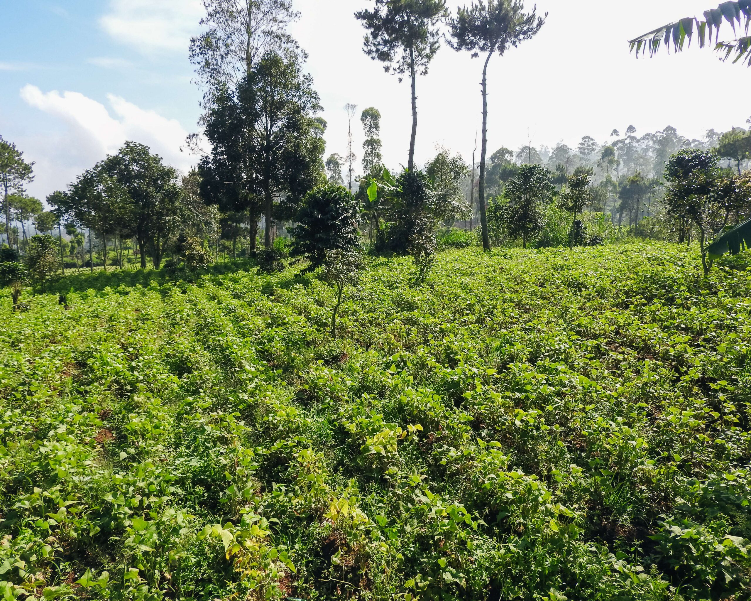
Indonesia has a strong commitment to reducing greenhouse gas (GHG) emissions through the forestry and other land use (FOLU) sector. This commitment is outlined in the FOLU Net Sink 2030 policy, which aims for the FOLU sector to become a net carbon sink by 2030. To support this target, direct interventions at the site level are required through strategies such as reforestation, land rehabilitation, and sustainable forest management.
One relevant implementation approach in the context of land rehabilitation and increasing carbon sequestration is agroforestry, a land-use system that combines agricultural crops with trees within a single unified ecosystem. Agroforestry is considered effective because, in addition to increasing land cover and carbon sequestration, it also provides direct economic value to local communities.
West Java, as one of the priority provinces in the operational plan of the FOLU Net Sink 2030, has various strategic areas for agroforestry development, including forest buffer zones and other utilization areas (APL) such as Cikembang Village. Cikembang Village, Kertasari District, is a village with high potential for community-based agroforestry development. This village features hilly topography, a declining forest cover, and community lands that are partially not yet managed optimally.
However, to date, comprehensive and verified baseline data regarding the biophysical, socio-economic, and carbon sequestration potential conditions in this region are not yet available. Therefore, preparing a baseline data report in Cikembang Village serves as an important initial step in designing, implementing, and monitoring the effectiveness of agroforestry activities as part of local-level GHG emission mitigation efforts.
There are 3 initial methods used for data collection:
Area Mapping Method
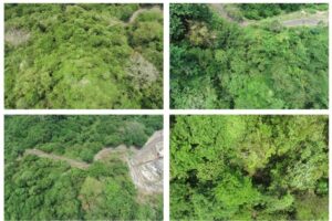
The area mapping phase utilizes remote sensing techniques carried out using an unmanned aerial vehicle (UAV) or drone. Remote sensing techniques offer advantages in gathering spatial-temporal information to capture the biophysical properties of forests for assessing biomass and carbon stocks (Ota, et.al, 2017). Data collection utilizing a UAV-based platform features high operational flexibility in terms of cost, time, place, and repeatability compared to satellite-based platforms and traditional manned photogrammetric operations (Dhruva et al., 2024). UAV platforms can capture high-resolution images that can be used effectively and efficiently to generate digital terrain models (DTM), digital surface models (DSM), and ortho-mosaic images (Dhruva et al., 2024).
Carbon Stock Estimation Method
This initial survey aims to estimate above-ground biomass carbon stocks (AGB → C) across a 116 ha simple agroforestry plot using a non-destructive approach, meaning all measurements are taken without cutting down or damaging vegetation. The design follows IPCC and ICRAF/World Agroforestry guidelines: the main variables recorded are DBH for all individuals ≥ 5 cm, tree height across a representative subset per diameter class to mitigate allometric bias, species identity (for extracting wood density, ρ), along with documentation of stand position and condition.
The method used to determine carbon stock potential is conducted via a non-destructive method for tree stands and a destructive method for understory vegetation. The non-destructive method is applied if the allometric formula for the measured plant species is already known. Meanwhile, the destructive method is conducted by researchers to develop allometric formulas, particularly for tree species with specific branching patterns whose general allometric equations are not yet established.
Socio-Economic Data Collection Method
Socio-economic data collection is carried out using two methods: qualitative interviews and observation. The qualitative interview method is a data collection technique in qualitative research conducted through in-depth conversations between the researcher and informants to explore views, experiences, and meanings that individuals assign to a social phenomenon. These interviews are open-ended and flexible, allowing the researcher to adjust questions based on the informant’s responses so that the gathered data is richer and deeper. Qualitative interviews are generally used when researchers want to understand social reality from the participants’ perspective, rather than simply measuring variables or seeking generalizations. This type of interview can be structured, semi-structured, or unstructured, depending on the research objectives and the depth of information to be explored.
Cikembang Village is one of the villages located in Kertasari District, Bandung Regency, West Java Province. Administratively, Cikembang Village shares the following territorial borders:
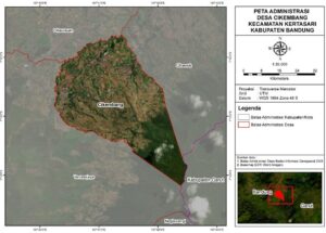
In general, the territory of Cikembang Village is dominated by agricultural lands, plantations, and forest areas positioned on mountain slopes. This geographical condition gives the village an important role in the agricultural sector, particularly in highland vegetables, and places it as part of the water catchment area in the upper reaches of the Citarum River.
Based on 2022 data from the Central Bureau of Statistics (BPS), the area of Cikembang Village, Kertasari District, Bandung Regency, is 1,372.53 ha or equivalent to 13.73 km². The topographical condition of this village area is dominated by hills. The registered population stands at 6,979 residents with a total of 2,496 households. Thus, the population density of Cikembang Village reaches approximately 509 people/km², indicating a relatively high density level compared to rural areas in general. Demographic information is summarized in the table below:
|
No |
Description | Unit | Total |
Notes |
|
1. |
Total Population |
people |
6979 |
|
|
2. |
– Male |
people |
3585 |
Includes children |
|
3. |
– Female |
people |
3394 |
|
|
4. |
Total Area |
km² |
13.73 |
|
|
5. |
Population Density |
people/km² |
508.3 |
Land cover in the Wanajaya Village Forest Management Institution (LPHD Wanajaya) area of Cikembang Village is directly observed through an orthomosaic map. An orthomosaic map is the result of merging high-resolution aerial imagery obtained through photography using a drone or unmanned aerial vehicle. This map can provide spatial details with excellent accuracy, allowing it to be used as a baseline for analyzing land cover within an area. Through an orthomosaic, differences in land cover characteristics such as settlements, agricultural land, dense vegetation, or open terrain can be clearly identified visually. Another advantage of this map is its relatively high geometric and radiometric accuracy, providing a realistic representation of real-world land conditions in the field (Colomina & Molina, 2014). The orthomosaic map of the LPHD Wanajaya area can be viewed in the image below.
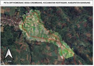
Based on the image, the area bounded by the red line represents the study area border. The image displays variations in color brightness levels across the land cover. Areas that appear brighter generally indicate open land or land with lower vegetation cover. This zone is dominated by vegetable cultivation fields, freshly tilled land, or land experiencing a decrease in vegetation density due to soil cultivation processes. These bright color characteristics indicate that the land has a minimal tree canopy, causing light reflection from the soil surface to be stronger compared to dense vegetation areas.
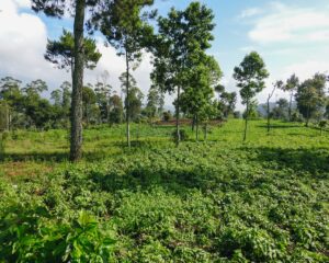 Land cover in the LPHD Wanajaya area of Cikembang Village is dominated by plots utilized for horticulture cultivation. Horticulture/Vegetables commonly grown by tenant farmers include cabbage, scallion, carrot, and potato. In several cultivated plots, many community members have already planted woody crops, specifically coffee (Coffea sp). In addition, other woody trees found in the cultivated land plots include Avocado (Persea americana), Cinnamon (Cinnamomum burmannii), Timor white gum (Eucalyptus urophylla), Manglid (Manglietia glauca), Oak (Quercus sp.), Pine (Pinus merkusii), Rasamala (Altingia excelsa), Indonesian bay leaf (Syzygium polyanthum), and Suren (Toona sureni).
In terms of vegetation structure, a visualization of the land cover within the LPHD Wanajaya cultivated land area can be viewed in the image below:
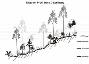 The profile diagram of Cikembang Village shows a vegetation structure still dominated by horticulture crops, particularly vegetables and seasonal crops. At an elevation of around 1550–1650 masl, the presence of coffee, banana, avocado, potato, and carrot dominates the lower to middle sections of the slope. These crops are relatively short, ranging from 1–8 meters, and are primarily intended for self-consumption or marketplace demands. Meanwhile, the presence of tall trees such as eucalyptus, rasamala, suren, and manglid appears scattered, meaning large tree crowns have not yet become a dominant canopy.
At higher elevations, around 1700–1770 masl, a similar pattern remains visible with the presence of potato, scallion, and coffee planted near shade trees like sugar palm and pine. This indicates that the vegetation structure in Cikembang Village still places greater emphasis on horticulture productivity rather than forming a developed forest stand structure. With the dominance of seasonal and horticultural crops, this village landscape displays a simple agroforestry pattern, where woody and hardwood trees serve merely as complementary elements rather than the primary structure of the ecosystem.
The elevation of a location is an important parameter in environmental and land-use studies. Generally, elevation is measured from sea level and expressed in meters above sea level (masl). Information regarding elevation is necessary because it influences various environmental factors such as air temperature, air humidity, soil moisture, and the types of vegetation capable of growing in an area. Higher elevations from sea level generally lead to lower air temperatures, while air humidity tends to increase. This condition has direct implications for agriculture, forestry, and environmental conservation planning.
In the context of sustainable development, information about slope gradients serves as an essential basis for determining soil and water conservation strategies. For instance, land with steep to very steep slopes carries a high risk of losing productive topsoil layers if not managed with proper conservation techniques. Conversely, flat to gently sloping lands are relatively better suited for intensive agricultural cultivation, yet still require management to prevent soil quality degradation. Therefore, slope gradient analysis not only helps in land utilization decision-making but also supports efforts to maintain ecosystem balance and reduce the potential for environmental disasters.
Soil is a vital environmental factor in determining land suitability for agriculture, forestry, or conservation. Soil characteristics, including its physical, chemical, and biological properties, influence the soil’s capacity to support plant growth and maintain ecosystem balance. Each soil type has unique traits regarding texture, fertility, and acidity levels, making an understanding of an area’s soil types a fundamental basis for sustainable land management.
Air humidity data for the 2020–2024 period in this analysis uses the Relative Humidity at 2 Meters (%) parameter from the NASA POWER dataset. Relative Humidity at 2 Meters (%) is a climate parameter that describes the amount of water vapor contained in the air at a height of 2 meters from the ground surface compared to the maximum capacity of the air to hold water vapor at a specific temperature. This data is available from the NASA Prediction Of Worldwide Energy Resources (POWER) database, which is widely used for climate, agriculture, and renewable energy studies because it provides global meteorological data with high spatial and temporal resolution (Stackhouse et al., 2018).
Soil moisture data for the 2020–2024 period in this analysis uses the Profile Soil Moisture parameter from the NASA POWER dataset. Profile Soil Moisture is defined as the soil water content down to a profile depth of about 1 meter, representing water availability throughout the soil layers where plant roots can grow.
Air temperature data for the 2020–2024 period uses the Earth Skin Temperature (EST) parameter from the NASA POWER dataset. The choice of Earth Skin Temperature (EST) as the air temperature parameter in this study is based on the fact that EST represents the temperature of the Earth’s surface measured by satellite sensors with consistent temporal and spatial resolution. EST describes the thermal energy stored and emitted by the Earth’s surface, allowing it to represent micro- and macro-climatic conditions more accurately than conventional air temperature measurements taken at the surface (Wan, 2014).
Soil temperature data for the 2020–2024 period uses the Soil Temperature Layer 1 parameter from the NASA POWER dataset. Utilizing Soil Temperature Layer 1 (STL1) as a parameter in climate studies is highly relevant because the topmost soil layer (0–10 cm) directly participates in energy, water, and gas exchange processes between the atmosphere and terrestrial ecosystems. The temperature in this layer reflects microclimatic conditions that influence soil biological activity, plant root growth, and organic matter decomposition processes (Batjes, 2014). Discussion around STL1 data is essential because its stability provides an overview of the soil’s capacity to store and release heat, which in turn impacts the hydrological cycle, agricultural productivity, and ecosystem dynamics.
Rainfall data for the 2020–2024 period uses the Precipitation Corrected Sum parameter from the NASA POWER dataset. The parameter applied is Precipitation Corrected Sum because PRECTOTCORR represents daily rainfall from the MERRA-2 reanalysis that has been corrected using rain gauge observation data to reduce “rain-day” frequency bias and accumulation amounts. In the MERRA-2 system, precipitation data used for land forcing is derived as the PRECTOTCORR variable; this correction follows an “observation-corrected precipitation forcing” scheme (including the use of CPCU/CMAP/GPCC data), making it more representative than raw model precipitation, particularly in tropical regions where observation networks are uneven.
Wind speed data for the 2020–2024 period uses the Wind Speed at 2 Meters Maximum (m/s) and Wind Speed at 2 Meters Minimum (m/s) parameters from the NASA POWER dataset. The definitions are: maximum wind speed indicates the highest wind speed value occurring at a height of 2 meters from the ground surface within a daily range, while minimum wind speed indicates the lowest value at the same level. This data is important because it illustrates wind kinetic energy fluctuations that impact the microclimate, hydrological cycle, and renewable energy potential.
The legal foundation (legal basis) for the LPHD Wanajaya social forestry group in Cikembang Village, Kertasari District, Bandung Regency is as follows:
At present, the potentials that must be guarded and maintained at the location include woody plant species (Rasamala, Pine, Dammar, Salamander, etc.). Besides woody plants, there are also natural water springs holding high conservation value that need protection. At this location, there are also Non-Timber Forest Product (NTFP) plant species that can be harvested and utilized, such as coffee, avocado, jackfruit, banana, and passion fruit (konyal).
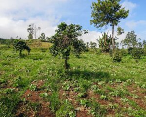
The livelihood of communities cultivating forest land areas is generally limited to their agricultural activities. Community members participate in the agricultural pipeline within the forest land area, ranging from being cultivated land holders, farm laborers managing the plots, transport laborers moving fertilizers and harvests, to becoming traders where land cultivators sell their produce. These roles and activities show how the community depends on the land not only to meet food needs but also makes forest management their primary source of income.
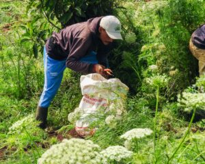 The land cultivators in the forest area of Cikembang Village are members of LPHD Wanajaya, as listed in the forest management Decree issued by the MoEF (KLHK). They manage plots of land to cultivate various commodities, both vegetables such as scallion, potato, cabbage, and carrot, as well as non-vegetable crops like avocado, coffee, jackfruit, and banana. Each cultivator is responsible for tasks starting from planning garden layouts, preparing the land, planting seeds, to carrying out maintenance and harvesting, so that agricultural yields can be used for self-consumption or sold to meet the family’s economic needs.
Currently, most community members prefer growing vegetables as their primary commodity. Although vegetable market prices tend to fluctuate, the community feels that yields can be obtained faster compared to non-vegetable crops, making them more suitable for short-term economic needs. Based on the latest survey, vegetable selling prices are currently experiencing a decline, namely scallions at IDR 7,000/kg, potatoes at IDR 10,000/kg, cabbage at IDR 5,000/kg, and carrots at IDR 1,000/kg.
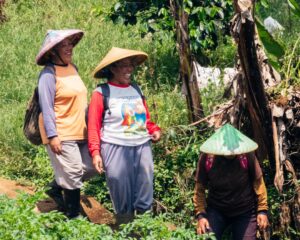
The community of Cikembang Village bordering the forest has long held a high dependence on forest resources as the main anchor of their lives. Limited private agricultural lands, high food demands, and economic urgency forced some community members to utilize lands within state forest areas previously managed by Perum Perhutani.
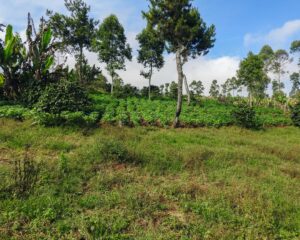 In the past, the cultivation of forest land by the community was often viewed as encroachment or an infraction. However, the government eventually realized that involving the community could instead play a role in conserving forests while improving their welfare. This subsequently gave birth to various policies, beginning with the Intercropping Program (Tumpangsari/Tebang Butuh Tanam) during the colonial era, which later evolved into Collaborative Forest Management (PHBM) managed by Perhutani, with the Forest Village Community Institution (LMDH) as its partner.
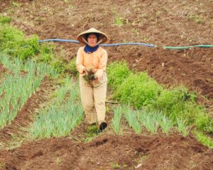 Through the PHBM program, residents gained opportunities to plant secondary crops (palawija), horticulture, or other plantation commodities among forest tree stands such as cinnamon, eucalyptus, and pine. For the community, this activity became a means to fulfill food needs, increase household income, and create new jobs around the forest area. Meanwhile, for Perhutani, the intercropping system applied by the community contributed to main crop maintenance, suppressed wild encroachment potential, and strengthened social relations and cooperation with communities around the forest.
In implementing the agroforestry revitalization program based on cultural heritage in Cikembang Village, there are several key actors who possess strategic and complementary roles.
First, the Village Government holds the main role in providing legitimacy, coordination, and oversight functions. Full support from the Village Government serves as an essential foundation because it ensures every activity runs according to regulations and aligns with the village development plan. With high influence and a positive stance, the presence of the village government serves as a catalyst for program sustainability.
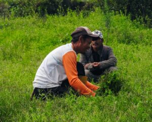 Second, the Village Forest Management Institution (LPHD) Wanajaya functions as the holder of permit access for forest area management as well as the executor of forest protection and rehabilitation (RHL). LPHD has a strong interest in strengthening institutional structures and ensuring program benefits can be felt by members and the surrounding community. With a strategic position and significant influence, LPHD’s support is highly deterministic to the success of community-based management.
Third, the Social Forestry Business Group (KUPS) Pangsileman acts as a key actor at the site level, holding direct responsibility over the program locus in Cikembang. KUPS’s primary expectation is to improve member welfare through agricultural product diversification and business development based on non-timber forest products. Positive support from KUPS with high capacity of influence indicates strong motivation to optimize economic benefits while maintaining environmental sustainability.
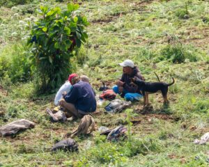
Overall, the involvement of these three stakeholders creates synergy across regulatory, institutional, and community economic aspects. This synergy is an important factor in guaranteeing program sustainability and achieving long-term objectives in Cikembang Village.
Based on the Results and Discussion in the previous chapter, the conclusions of this report are as follows:
The complete activity report can be downloaded at the following link: