


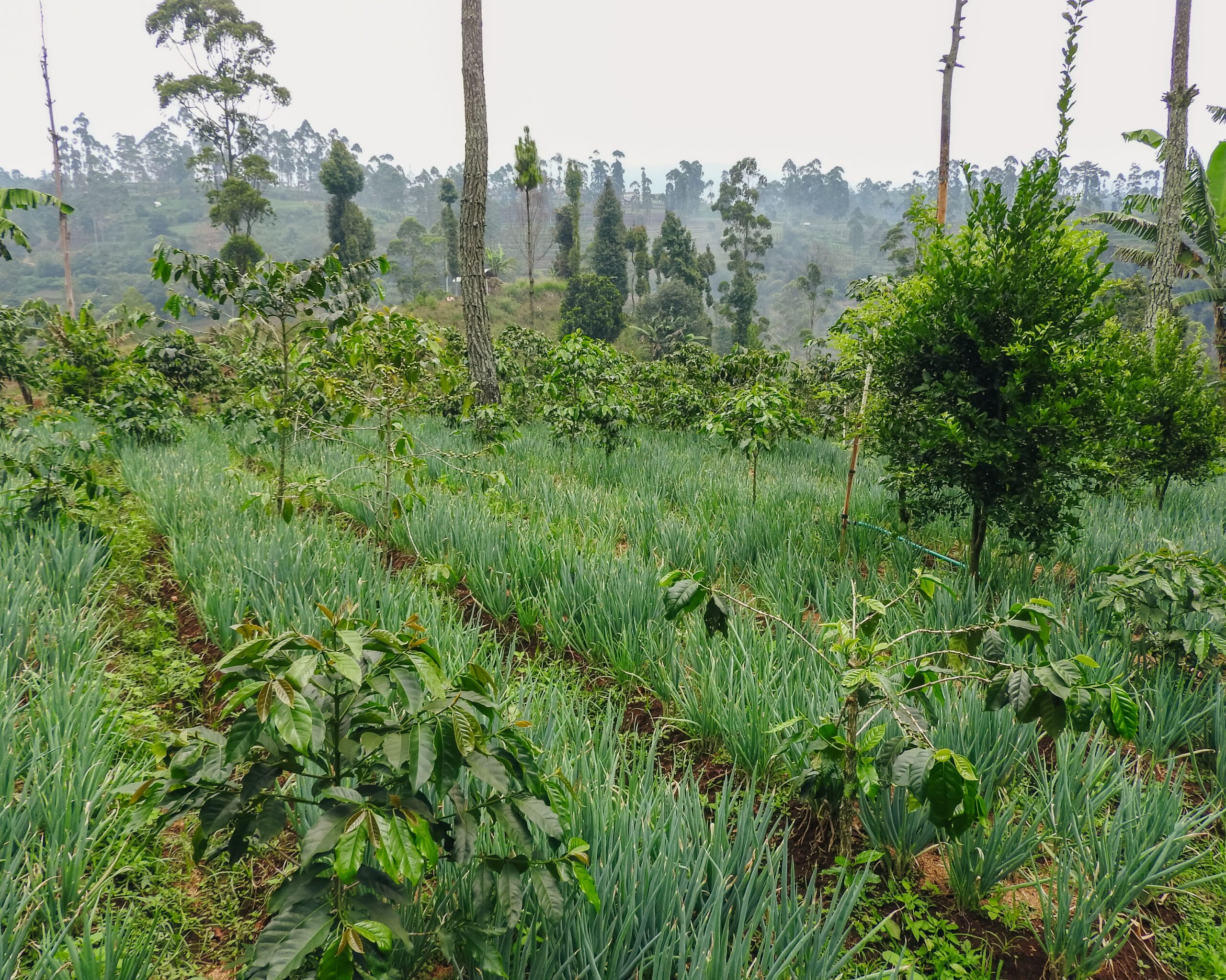
Indonesia has a strong commitment to reducing greenhouse gas (GHG) emissions through the forestry and other land use (FOLU) sector. This commitment is articulated in the FOLU Net Sink 2030 policy, which targets the FOLU sector to become a net carbon sink by 2030. To support this target, direct intervention at the site level is required through strategies such as reforestation, land rehabilitation, and sustainable forest management.
One relevant implementative approach in the context of land rehabilitation and carbon sequestration enhancement is agroforestry, a land-use system that combines agricultural crops with trees within a single ecosystem. Agroforestry is considered effective because, in addition to improving land cover and carbon uptake, it also provides direct economic value to surrounding communities.
West Java, as one of the priority provinces in the FOLU Net Sink 2030 operational plan, has various strategic areas for agroforestry development, including forest buffer zones and other use areas (APL) such as Sukapura Village. Sukapura Village, Kertasari District, is one of the villages with high potential for community-based agroforestry development. The village has hilly topography, declining forest cover, and community land that has not been optimally managed.
However, to date, complete and verified baseline data on biophysical conditions, socio-economic conditions, and carbon sequestration potential in this area have not been available. Therefore, the preparation of a baseline data report in Sukapura Village is an important initial step in designing, implementing, and monitoring the effectiveness of agroforestry activities as part of local-level GHG emission mitigation efforts.
There are 3 initial methods in data collection, namely:
Area Mapping Method
In the area mapping phase, remote sensing techniques are employed using unmanned aerial vehicles (UAVs) or drones. Remote sensing techniques have advantages in obtaining spatio-temporal information to determine forest biophysical properties and assess biomass and carbon stocks (Ota, et.al, 2017). Data collection using UAV-based platforms offers high operational flexibility in terms of cost, time, location, and repetition compared to satellite-based platforms and traditional manned photogrammetric operations (Dhruva et al., 2024). UAV platforms can capture high-resolution images that can be used effectively and efficiently to generate digital terrain models (DTM), digital surface models (DSM), and ortho-mosaic images (Dhruva et al., 2024).
Carbon Stock Estimation Method
This initial survey aims to estimate above-ground carbon stocks (AGB → C) in a 116 ha simple agroforestry area using a non-destructive approach, so all measurements are conducted without cutting or damaging vegetation. The design follows IPCC and ICRAF/World Agroforestry guidelines: the main variables recorded are DBH for all individuals ≥ 5 cm, tree height on a representative subset per diameter class to reduce allometric bias, species identification (for wood density, ρ, extraction), as well as documentation of stand position and condition.
The method used to determine carbon stock potential employs non-destructive methods for tree stands and destructive methods for understory vegetation. The non-destructive method is used when the allometric equation of the measured plant species is already known. Meanwhile, the destructive method is carried out by researchers for the purpose of developing allometric equations, particularly for tree species with specific branching patterns whose allometric equations are not yet generally known.
Socio-Economic Data Collection Method
Socio-economic data collection is conducted using two methods: qualitative interviews and observation. Qualitative interviews are a data collection technique in qualitative research conducted through in-depth conversations between researchers and informants to explore views, experiences, and meanings that individuals attach to social phenomena. These interviews are open and flexible, allowing researchers to adjust questions based on informants’ responses so that the data obtained are richer and more in-depth. Qualitative interviews are generally used when researchers want to understand social reality from participants’ perspectives, not merely to measure variables or seek generalizations. This type of interview can be structured, semi-structured, or unstructured, depending on the research objectives and the depth of information to be explored.
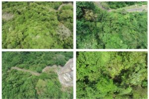
Example of UAV Aerial Photo Results
Sukapura Village is one of the villages located in Kertasari District, Bandung Regency, West Java Province. Administratively, Sukapura Village has the following territorial boundaries:
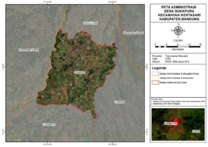
Administrative Map of Sukapura Village
In general, Sukapura Village’s territory is dominated by agricultural land, plantations, and forest areas located on mountain slopes. This geographical condition gives the village an important role in the agricultural sector, particularly highland vegetables, and makes it part of the watershed area in the upper reaches of the Citarum River.
Based on data from the Central Statistics Agency (BPS) for 2022, the area of Sukapura Village, Kertasari District, Bandung Regency, is 596.7 ha, equivalent to 5.97 km². The topography of this village area is dominated by hills. The population is recorded at 6,799 people with 2,911 households. Thus, the population density of Sukapura Village reaches approximately 1,544 people/km², indicating a relatively high density compared to rural areas in general. Demographic information is summarized in the table below.
|
No |
Description |
Unit |
Amount |
Notes |
|
1. |
Total Population |
people |
9217 |
|
|
2. |
– Male |
people |
4725 |
Including children |
|
3. |
– Female |
people |
4492 |
|
|
4. |
Area |
km² |
5.97 |
|
|
5. |
Population Density |
people/km² |
1.544 |
|
Land cover in KPS Reksawana, Sukapura Village, is observed directly through orthomosaic maps. The orthomosaic map is the result of combining high-resolution aerial images obtained through drone or UAV photography. This map is able to present spatial information with excellent detail, making it suitable as a basis for land cover analysis in an area. Through orthomosaics, differences in land cover characteristics such as settlements, agricultural land, dense vegetation, and open land can be clearly identified visually. Another advantage of this map is its relatively high geometric and radiometric accuracy, enabling a realistic depiction of field land conditions (Colomina & Molina, 2014). The orthomosaic map of the KPS Reksawana area can be seen in the image below.
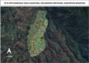
Orthomosaic Map of KPS Reksawana Area, Sukapura Village
Based on the image, the area bounded by the red line is the study area boundary. The image shows differences in brightness levels of land cover. Brighter areas generally indicate open land or land with lower vegetation cover. This area is dominated by vegetable farming plots, newly cultivated land, or land that has experienced reduced vegetation density due to soil tillage processes. These bright color characteristics indicate relatively minimal tree canopy cover, so light reflection from the ground surface is stronger compared to densely vegetated areas.
Land cover in the KPS Reksawana area of Sukapura Village is dominated by horticultural cultivation. The horticultural/vegetable crops commonly planted by land cultivators include cabbage, scallions, carrots, and potatoes. In some cultivated plots, many community members have planted woody crops such as coffee (Coffea sp). In addition, other woody plants were found on the edges of cultivated land, including Avocado (Persea americana), Sugar Palm (Arenga pinnata), Baros (Manglietia glauca), Jabon (Anthocephalus cadamba), Water Apple (Syzygium aqueum), Guava (Psidium guajava), White Teak (Gmelina arborea), Lemon (Citrus limon), Lime (Citrus aurantiifolia), Kaliandra (Calliandra calothyrsus), Cinnamon (Cinnamomum burmannii), Cajuput (Eucalyptus urophylla), Ki Damar (Agathis dammara), Mahogany (Swietenia macrophylla), African Mahogany (Khaya anthoteca), Mango (Mangifera indica), and Manglid (Manglietia glauca).
In terms of vegetation structure, a visualization of land cover in the KPS Reksawana Cultivated Land area can be seen in the image below.
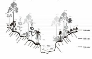
Vertical Structure of Land Cover in the KHDPK Sukapura Cultivated Land Area
The image shows a cross-section of the landscape in the KHDPK Sukapura area, which is a highland area around the Citarum River, showing elevation variations between 1,250 and 1,350 meters above sea level (masl). This cross-section shows a diverse arrangement of vegetation and crop commodities, arranged according to elevation differences and slope topography on both sides of the river. The vegetation pattern indicates species adaptation to different environmental conditions, in terms of humidity, light intensity, and soil type.
On the left slope side, at an elevation of approximately 1,350 masl, tall tree stands such as white teak reaching about 23 meters in height can be seen, combined with avocado, chili, eucalyptus, and coffee in the lower layer. Descending the slope toward the river, more varied vegetation such as chili, Rasamala, scallions, and bananas grow among the eucalyptus and coffee trees. This transition in plant types reflects changes in microclimate conditions toward greater humidity and shade as the river valley approaches.
In the valley bottom, at around 1,250 masl, the Citarum River flows flanked by medium-sized vegetation such as banana, Surian, Manglid, and Rasamala. The presence of trees with medium to large canopies plays an important role in maintaining soil moisture, preventing riverbank erosion, and maintaining the quality of the riparian zone. This valley zone appears to be an ecosystem transition area with high vegetation diversity.
On the right side of the river, on the slope rising back toward 1,350 masl, vegetation is dominated by tall stands such as Pine and Rasamala, combined with eucalyptus and manglid in the lower layer. Near the slope crest, the plant pattern shifts to intensive cultivation crops such as lime, planted regularly on gentler slopes. This vegetation arrangement indicates mixed land use between forestry trees and commercial agricultural crops, which simultaneously functions to maintain slope stability.
Physical environmental factors are the main components that influence ecosystem characteristics and land productivity. Biophysical conditions such as elevation above sea level, soil type, air humidity, soil moisture, air temperature, soil temperature, and rainfall interact to determine the ecological dynamics of an area. Location elevation is closely related to microclimate variations, where increasing elevation generally lowers temperature and affects vegetation distribution (Barry & Blanken, 2016). Air humidity and soil moisture are important factors in the hydrological cycle as they determine water availability for plants and other organisms (Rodriguez-Iturbe & Porporato, 2004).
Location elevation is one of the important parameters in environmental and land-use studies. Generally, elevation is measured from sea level and expressed in meters above sea level (masl). Elevation information is necessary because it influences various environmental factors such as air temperature, air humidity, soil moisture, and the types of vegetation that can grow in an area. The higher a location is above sea level, the lower the air temperature generally becomes, while air humidity tends to increase. These conditions have direct implications for agricultural activities, forestry, and environmental conservation planning.
In the context of sustainable development, information on slope gradient is an important basis for determining soil and water conservation strategies. Land with steep to very steep slopes, for example, has a high risk of losing productive topsoil if not managed with appropriate conservation techniques. Conversely, land with flat to gentle slopes is relatively more suitable for intensive agricultural cultivation but still requires management to prevent soil quality degradation. Therefore, slope gradient analysis not only helps in land-use decision-making but also supports efforts to maintain ecosystem balance and reduce the potential for environmental disasters.
Soil is a very important environmental factor in determining land suitability for agriculture, forestry, and conservation. Soil characteristics—physical, chemical, and biological—affect the soil’s ability to support plant growth and maintain ecosystem balance. Each soil type has its own distinctive characteristics in terms of texture, fertility, and acidity level, so understanding the soil type of an area is an important basis for sustainable land management.
Air humidity data for the 2020–2024 period in this analysis uses the Relative Humidity at 2 Meters (%) parameter from the NASA POWER dataset. Relative Humidity at 2 Meters (%) is a climate parameter that describes the amount of water vapor contained in the air at a height of 2 meters above the ground surface, compared to the maximum capacity of the air to hold water vapor at a given temperature. This data is available from the NASA Prediction Of Worldwide Energy Resources (POWER) database, which is widely used for climate, agricultural, and renewable energy studies as it provides global meteorological data with good spatial and temporal resolution (Stackhouse et al., 2018).
Soil moisture data for the 2020–2024 period in this analysis uses the Profile Soil Moisture parameter from the NASA POWER dataset. Profile Soil Moisture is defined as the soil water content at a profile depth of up to approximately 1 meter, representing water availability throughout the soil layers where plant roots can grow.
Air temperature data for the 2020–2024 period uses the Earth Skin Temperature (EST) parameter from the NASA POWER dataset. The use of Earth Skin Temperature (EST) as an air temperature parameter in this study is based on the fact that EST is the Earth’s surface temperature measured by satellite sensors with consistent temporal and spatial resolution. EST describes the thermal energy stored and emitted by the Earth’s surface, thus representing micro- and macro-climate conditions more accurately than conventional surface air temperature alone (Wan, 2014).
Soil temperature data for the 2020–2024 period uses the Soil Temperature Layer 1 parameter from the NASA POWER dataset. The use of Soil Temperature Layer 1 (STL1) as a parameter in climate studies is highly relevant because the topsoil layer (0–10 cm) plays a direct role in energy, water, and gas exchange processes between the atmosphere and terrestrial ecosystems. The temperature of this layer reflects microclimate conditions that affect soil biological activity, plant root growth, and organic matter decomposition processes (Batjes, 2014). STL1 data is important to discuss because its stability can provide an indication of the soil’s capacity to store and release heat, which in turn impacts the hydrological cycle, agricultural productivity, and ecosystem dynamics.
Rainfall data for the 2020–2024 period uses the Precipitation Corrected Sum parameter from the NASA POWER dataset. The parameter used is Precipitation Corrected Sum because PRECTOTCORR is daily rainfall from MERRA-2 reanalysis that has been corrected with gauge-based observation data to reduce the frequency bias of “rainy days” and accumulation amounts. In the MERRA-2 system, the precipitation data used for land forcing is derived as the PRECTOTCORR variable; this correction follows the “observation-corrected precipitation forcing” scheme (including the use of CPCU/CMAP/GPCC data) so that it is more representative than raw model precipitation, especially in tropical regions where observation networks are unevenly distributed.
Wind speed data for the 2020–2024 period uses the Wind Speed at 2 Meters Maximum (m/s) and Wind Speed at 2 Meters Minimum (m/s) parameters from the NASA POWER dataset. Definitions: maximum wind speed indicates the highest wind speed value occurring at a height of 2 meters above the ground surface within a daily range, while minimum wind speed indicates the lowest value at the same level. This data is important because it describes wind kinetic energy fluctuations that affect microclimate, hydrological cycles, and renewable energy potential.
The legal basis of the social forestry group LPHD Wanajaya, Sukapura Village, Kertasari District, Bandung Regency, is as follows:
Currently, the potentials that must be protected and maintained at the location include timber tree species (Rasamala, Pine, Damar, Salamander, and others). In addition to timber trees, there are also springs with high conservation value that need to be preserved. At this location, there are also Non-Timber Forest Products (NTFPs) that can be harvested and utilized, such as coffee, avocado, jackfruit, banana, and kapul.
The livelihoods of forest cultivators in Sukapura Village rely on an interconnected agricultural work chain. In this chain, each person takes a different role: there are land owners/cultivators, farm laborers who handle cultivation from land preparation to harvesting, transport laborers who move fertilizers and harvest yields, and traders who collect and distribute commodities. This interconnected network of roles not only meets household food needs but also serves as an income driver that moves the local economy around the forest.
The cultivators who manage plots in the forest area are members of KPS Reksawana and are listed in the forest management decree issued by the Ministry of Environment and Forestry. The commodities grown are diverse, including vegetable commodities (scallions, potatoes, cabbage, carrots) and non-vegetable commodities (avocado, lime, coffee, jackfruit, banana). The cultivators’ tasks include garden layout planning, soil tillage, planting, maintenance, and harvesting so that the produce can be consumed or sold to meet family economic needs. Currently, vegetables are preferred as the main commodity because of their quick turnover despite fluctuating prices. The latest survey results show prices are weakening, with details: scallions at Rp8,000/kg, potatoes at Rp8,000–10,000/kg, cabbage at Rp4,000/kg, and carrots at Rp2,000/kg.
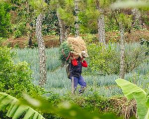
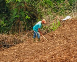
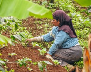
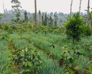
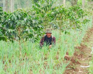
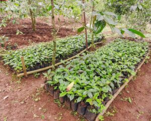
The people of Sukapura Village, who live adjacent to forest areas, have long depended on forest resources for their livelihoods. Limited private land ownership, increasing food needs, and economic pressures have encouraged some residents to utilize state forest land previously managed by Perum Perhutani.
The implementation of environmental management and community empowerment programs in Sukapura Village cannot be separated from the roles of local actors who have different interests, influences, and responsibilities. Two key actors who are the main drivers in the implementation of these activities are the Sukapura Village Government and the KPS Reksawana Social Forestry Group.
Based on the discussion results in the previous chapter, the conclusions of this report are as follows:
The complete activity report can be downloaded at the following link: