


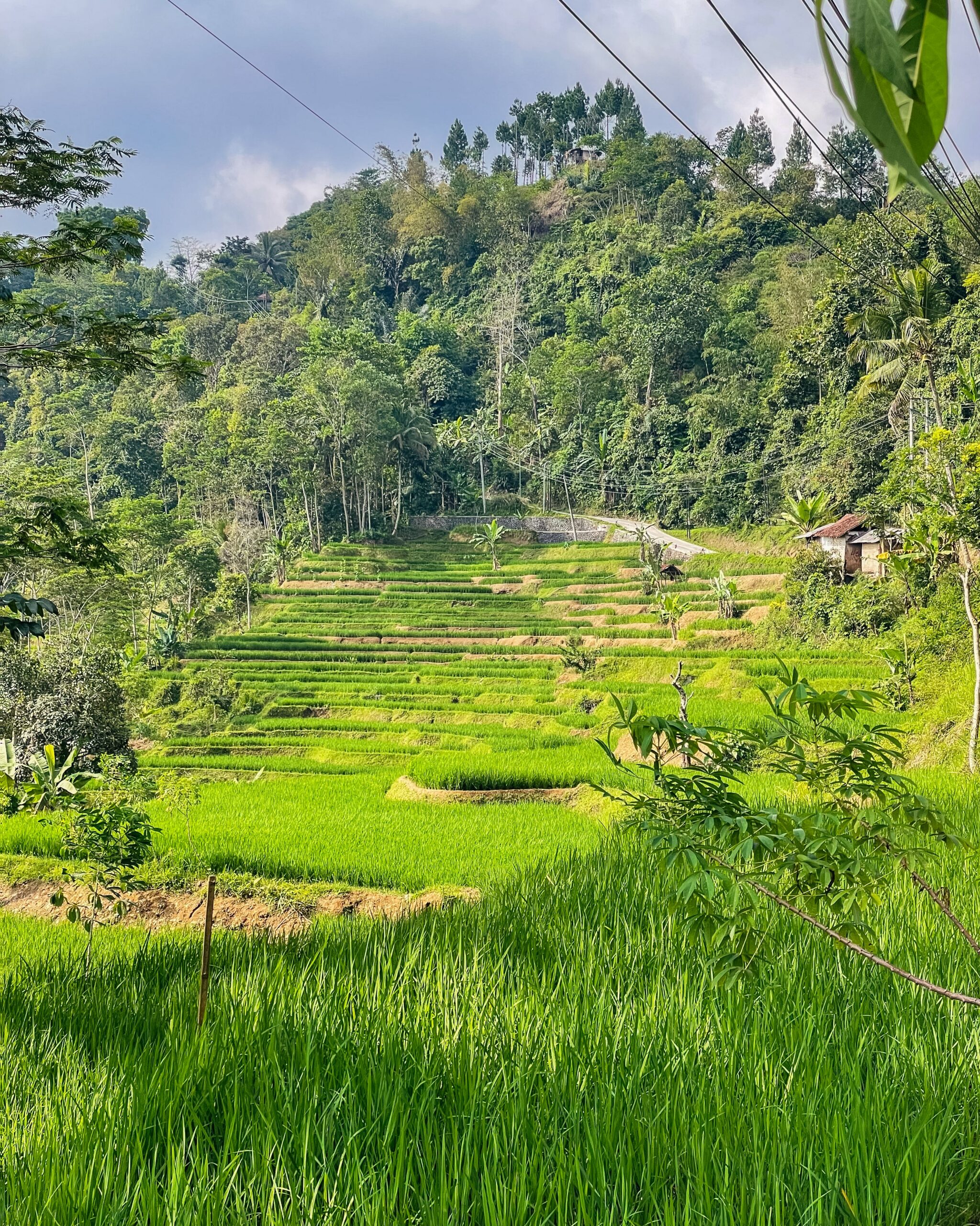
West Java, as one of the priority provinces in the FOLU Net Sink 2030 operational plan, has various strategic areas for agroforestry development, including forest buffer zones and other utilization areas (APL) such as Mekarmulya-Kubang Village. Mekarmulya-Kubang Village, Kertasari District, is a village with high potential for community-based agroforestry development. This village has a hilly topography, a declining forest cover, and community land that has partially not been optimally managed.
However, a comprehensive and verified baseline database regarding biophysical, socio-economic, and carbon sequestration potential conditions in this region is not yet available. Therefore, the preparation of a baseline data report for Mekarmulya-Kubang Village is an essential initial step in designing, implementing, and monitoring the effectiveness of agroforestry activities as part of GHG emission mitigation efforts at the local level.
The administrative location points for the planned field school development are located in Mekarmulya Village, Pasirkuda District, Cianjur Regency, West Java Province. Visually, the target location points for the field school development.
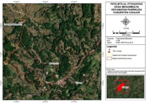
Based on the image and satellite imagery interpretation, the coordinate is situated within a built-up land/village settlement area with a linear settlement distribution following the main Mekarmulya–Kubang road. The surrounding land use forms a rural mosaic: mixed gardens/community agroforestry on the hillsides, rice paddies/cultivated fields in flat areas and gentler valleys, as well as dense vegetation cover (wood lots/community forests/shrubs) on the surrounding hills; overall, the landscape functions dominantly as a cultivation and settlement zone that supports the socio-educational activities of the village community.
Administratively, Mekarmulya Village and Kubang Village directly border each other. The administrative maps of Mekarmulya Village and Kubang Village can be seen as follows:
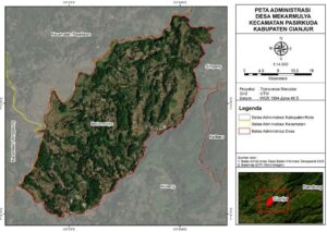
Mekarmulya Village is located in Pasirkuda District, Cianjur Regency, West Java. The village boundaries are indicated by a red line. Regionally, Mekarmulya is bordered to the east-northeast by Simpang Village, to the southeast by Kalibaru Village, to the south-southwest by Kubang Village, while the west to northwest sides border across sub-districts with Tanggeung District and close to the Pagelaran District boundary at the northwest end.
Based on the image, the base imagery shows a hilly rural landscape with settlements scattered along the road network, as well as a mosaic of mixed gardens and cultivated land on the slopes. This confirms the dominant spatial function of the village as a cultivation and settlement zone.
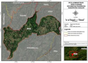
Kubang Village is situated in Pasirkuda District, Cianjur Regency, West Java. The village border is depicted by a red line, showing a territory stretching from northwest to southeast. Regionally, Kubang Village is bordered by Mekarmulya Village to the northwest, Simpang Village to the north, Kalibaru Village to the northeast, and Girijaya Village to the southeast; while on the west and south sides, it shares inter-district borders with Tanggeung District, and meets the Pagelaran District boundary at the northwest (district borders are indicated by yellow lines).
Based on the image, the base imagery displays a hilly rural landscape dominated by mixed gardens/community agroforestry. The residential areas are scattered along the road network, followed by paddy/cultivated land use in the valleys—reflecting the primary spatial function of the village as a cultivation and residential area.
Kubang Village (Pasirkuda District, Cianjur Regency). Referring to the publication of Pasirkuda District in Figures 2024 (BPS), the total area of Kubang Village reaches 15.20 km². In 2023, the population was recorded at 4,170 people (2,252 males and 1,918 females) with a density of 274.34 people/km², representing 11.60% of the total district population, and a sex ratio of 117.41. Entering Semester I of 2024, the population increased to 4,357 people (2,337 males and 2,020 females) with a density of 286.64 people/km², a population share of 11.67%, and a sex ratio of 115.69. In general, these figures depict a relatively densely populated rural village set in the hilly landscape of Pasirkuda.
Mekarmulya Village (Pasirkuda District, Cianjur Regency). Based on the same source, the total area of Mekarmulya Village is 12.28 km². In 2023, the population stood at 3,353 people (1,766 males and 1,587 females) with a density of 273.05 people/km², a population percentage of 9.33% in the district, and a sex ratio of 111.28. In Semester I of 2024, the total population rose to 3,448 people (1,810 males and 1,638 females) with a density of 280.78 people/km², contributing 9.23% to the total district population, and a sex ratio of 110.50. Briefly, Mekarmulya reflects a cultivation-residential village in a hilly area with medium density for a rural context.
The land cover at the planned field school development site at MTs Al-Ittihadiyah, Mekarmulya-Kubang Village, can be viewed directly through orthomosaic maps. An orthomosaic map is the result of combining high-resolution aerial imagery obtained via photography using drone units or unmanned aerial vehicles. This map is capable of presenting highly detailed spatial information, making it suitable as a basis for land cover analysis in a region. Through the orthomosaic, differences in land cover characteristics such as settlements, agricultural land, dense vegetation, or open land can be clearly identified visually. Another advantage of this map is its relatively high geometric and radiometric accuracy, providing a realistic representation of field land conditions (Colomina & Molina, 2014).
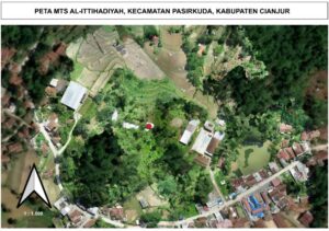
The displayed orthomosaic map is the result of spatial environment interpretation around MTs Al-Ittihadiyah, located in Pasirkuda District, Cianjur Regency. This map is presented at a scale of 1:1,500, enabling a detailed representation of land use around the school, including residential settlements, terraced agricultural land, vegetation zones, water bodies in the form of ponds, and the village road network connecting the area.
The red dot identified on the map marks the location for the planned Field School development. The choice of this location factors in the availability of relatively open land, proximity to central school activities, as well as decent accessibility to road infrastructure and adjacent productive land uses. Consequently, the area is deemed strategic to support practice-based learning activities, particularly those oriented toward utilizing local resources, environmental education, and building students’ skills. Functionally, this orthomosaic map acts as a spatial analysis instrument supporting the school development planning process. Furthermore, this map provides a scientific basis for integrating educational aspects with the biophysical and socio-economic potentials of the surrounding community, ensuring that the Field School development can be directed in a more measurable, sustainable, and locally contextual manner.
In terms of vegetation structure, the visualization of land cover in the planned field school development area in Mekarmulya – Kubang Village can be seen in the image below:
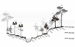
From an educational standpoint, this complex vegetation structure is highly relevant for establishing an agroforestry-based Field School, as students can learn directly about interactions between plant strata, soil and water conservation principles, and crop diversification. Through field practice approaches, the school can introduce applicable ecological knowledge while raising awareness about the importance of sustainable land management.
Socio-economically, the multi-strata agroforestry pattern delivers tangible benefits to the local community. The presence of hardwood trees ensures long-term economic potential, while fruit and plantation crops yield sustainable short- and medium-term benefits that can be harvested regularly. This condition builds a multi-layered income system for the community, capable of increasing household economic resilience while strengthening social bonds through mutual cooperation (gotong royong) practices in land maintenance.
Thus, the representation of vegetation stratification in this image serves not only as an ecological snapshot of the area but also underscores the potential for integrating education, ecology, and economy through the development of an agroforestry-based Field School that supports environmental sustainability and local community welfare.
Environmental physical factors are primary components influencing ecosystem characteristics and land productivity. Biophysical conditions such as elevation above sea level, soil type, air humidity, soil moisture, air temperature, soil temperature, and rainfall interact with each other to determine the ecological dynamics of a region. Location elevation is closely linked to microclimate variations, where an increase in elevation generally decreases temperature and affects vegetation distribution (Barry & Blanken, 2016). Air humidity and soil moisture are essential factors in the hydrological cycle because they determine water availability for plants and other organisms (Rodriguez-Iturbe & Porporato, 2004).
Soil is a crucial environmental factor in determining land suitability for agriculture, forestry, and conservation. Soil characteristics, including physical, chemical, and biological properties, influence the soil’s ability to support plant growth and maintain ecosystem balance. Each soil type has its own unique characteristics in terms of texture, fertility, and acidity levels, making an understanding of regional soil types an essential foundation for sustainable land management.
The elevation of a location is an important parameter in environmental and land use studies. Generally, elevation is measured from sea level and expressed in meters above sea level (masl). Information regarding elevation is required because it affects various environmental factors, such as air temperature, air humidity, soil moisture, and the types of vegetation that can grow in a region. Higher locations from sea level generally experience lower air temperatures, while air humidity tends to increase. This condition has direct implications for agricultural activities, forestry, and environmental conservation planning.
In the context of sustainable development, information about slope incline serves as an important base for determining soil and water conservation strategies. For instance, land with steep to very steep slopes carries a high risk of losing productive topsoil if not managed with proper conservation techniques. Conversely, flat to gently sloping land is relatively more suitable for intensive agricultural cultivation, yet still requires management to prevent soil quality degradation. Therefore, slope incline analysis not only aids in land use decision-making but also supports efforts to preserve ecosystem balance and mitigate potential environmental disasters.
Air humidity data for the 2020–2024 period in this analysis utilizes the Relative Humidity at 2 Meters (%) parameter from the NASA POWER dataset. Relative Humidity at 2 Meters (%) is a climate parameter describing the amount of water vapor contained in the air relative to the air’s capacity to hold water vapor at a specific temperature. This data is available from the NASA Prediction Of Worldwide Energy Resources (POWER) database, which is widely used for climate, agricultural, and renewable energy studies as it provides global meteorological data with solid spatial and temporal resolution (Stackhouse et al., 2018).
Relative humidity is a vital environmental factor across various ecological and agricultural aspects. Humidity levels affect plant physiological processes, including transpiration, photosynthesis, and groundwater availability for roots. Additionally, air humidity plays a role in the hydrological cycle, surface energy balance, and the thermal comfort of humans and animals (Campbell & Norman, 2012). In an agroecosystem context, stable humidity tends to support plant growth, whereas fluctuations that are too high or low can negatively impact productivity.
Soil moisture data for the 2020–2024 period in this analysis uses the Profile Soil Moisture parameter from the NASA POWER dataset. Profile Soil Moisture is defined as the soil water content down to a profile depth of about 1 meter, representing water availability throughout the soil layers where plant roots can grow.
Air temperature data for the 2020–2024 period uses the Earth Skin Temperature (EST) parameter from the NASA POWER dataset. The usage of Earth Skin Temperature (EST) as the air temperature parameter in this study is based on the fact that EST is the earth’s surface temperature measured by satellite sensors with consistent temporal and spatial resolution. EST depicts the heat energy stored and emitted by the earth’s surface, allowing it to represent micro and macro climate conditions more accurately than conventional surface air temperature alone (Wan, 2014). This study is important because changes in the earth’s surface temperature are closely tied to global phenomena like climate change, vegetation dynamics, and the earth-atmosphere energy balance (Mildrexler et al., 2018). Moreover, EST data from NASA POWER offers long-term consistency useful for monitoring regional to global climate trends.
Based on the Discussion Results in the previous chapter, the conclusions of this report are as follows:
The complete activity report can be downloaded at the following link: